National Weather Service Heat Indices for Florida
JACKSONVILLE, Florida – The National Weather Service in Jacksonville has issued a forecast for North Florida predicting scattered showers and thunderstorms on Saturday, July 12, 2025.
According to NWS Jacksonville, showers and thunderstorms are expected to be more scattered today compared to Friday, with a few isolated strong storms possible later this afternoon and evening.
Stronger storms along the I-95 corridor and towards the coast will be capable of producing:
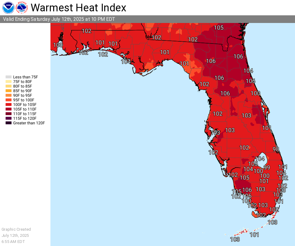
Additionally, elevated heat indices are expected today, with peak “feels like” temperatures of 103 to 107 degrees, hottest between 11 am and 5 pm. Stay hydrated, seek shade, never leave kids or pets in cars, and know the signs of heat illness.
North Florida cities at risk for strong thunderstorms include coastal regions, with specific cities in the shaded area such as:
Today
A slight chance of showers between noon and 2pm, then a chance of showers and thunderstorms. Mostly sunny, with a high near 95. Heat index values as high as 106. West wind around 8 mph. Chance of precipitation is 60%. New rainfall amounts between a tenth and quarter of an inch, except higher amounts possible in thunderstorms.
Tonight
A chance of showers and thunderstorms before midnight, then a slight chance of showers between midnight and 1am. Mostly cloudy, with a low around 77. South wind 6 to 8 mph. Chance of precipitation is 30%.
Sunday
A chance of showers, then showers and thunderstorms likely after 11am. Mostly sunny, with a high near 94. Heat index values as high as 109. West wind around 6 mph. Chance of precipitation is 70%. New rainfall amounts of less than a tenth of an inch, except higher amounts possible in thunderstorms.
Sunday Night
Showers and thunderstorms likely before 11pm, then a slight chance of showers between 11pm and 2am. Partly cloudy, with a low around 78. South wind around 5 mph becoming light and variable in the evening. Chance of precipitation is 60%.
Monday
A slight chance of showers, then showers and thunderstorms likely after 11am. Mostly sunny, with a high near 94. Northwest wind around 7 mph becoming northeast in the afternoon. Chance of precipitation is 70%.
Monday Night
Showers and thunderstorms likely before 11pm, then a slight chance of showers between 11pm and 2am. Partly cloudy, with a low around 76. Chance of precipitation is 60%.
Copyright 2023-2025 FloridaWord.com


