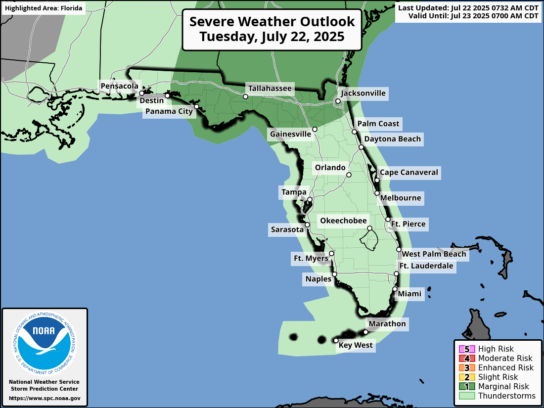
National Weather Service Storm Prediction Center Severe Weather Outlook for Florida Tuesday, July 22, 2025.
JACKSONVILLE, Florida – The National Weather Service in Jacksonville has issued a forecast for North Florida predicting strong to isolated severe thunderstorms on Tuesday, July 22, 2025.
According to NWS Jacksonville, thunderstorm coverage will increase this afternoon and evening, with strong to isolated severe thunderstorms possible.
Stronger storms along the I-95 corridor and inland areas will be capable of producing:
Additionally, a Heat Advisory is in effect today, with peak “feels like” temperatures of 105 to 110 degrees, hottest between 11 am and 6 pm. Stay hydrated, seek shade, never leave kids or pets in cars, and know the signs of heat illness.
North Florida cities at risk for strong thunderstorms include inland and coastal regions, with specific cities in the shaded area such as:
Today
Showers and thunderstorms likely, mainly after 3pm. Mostly sunny, with a high near 94. Heat index values as high as 108. West wind around 8 mph. Chance of precipitation is 60%. New rainfall amounts between a tenth and quarter of an inch, except higher amounts possible in thunderstorms.
Tonight
Showers and thunderstorms likely before 10pm. Mostly cloudy, with a low around 77. South wind 5 to 7 mph becoming calm after midnight. Chance of precipitation is 60%. New precipitation amounts between a quarter and half of an inch possible.
Wednesday
Showers likely before 11am, then showers and thunderstorms likely between 11am and 2pm, then showers likely and possibly a thunderstorm after 2pm. Mostly cloudy, with a high near 88. Southeast wind 6 to 11 mph. Chance of precipitation is 90%. New rainfall amounts between a half and three quarters of an inch possible.
Wednesday Night
Showers and thunderstorms before 11pm, then a chance of showers. Mostly cloudy, with a low around 77. Southeast wind 7 to 9 mph. Chance of precipitation is 80%.
Thursday
A slight chance of showers before 11am, then showers and thunderstorms likely after 11am. Partly sunny, with a high near 91. South wind 8 to 13 mph, with gusts as high as 16 mph. Chance of precipitation is 70%.
Thursday Night
Showers and thunderstorms likely before 11pm, then a slight chance of showers between 11pm and 2am. Partly cloudy, with a low around 77. Chance of precipitation is 60%.
Copyright 2023-2025 FloridaWord.com


