National Weather Service Miami South Florida Rain Chances
MIAMI, Florida – The National Weather Service (NWS) Miami has issued a warning for severe thunderstorms across South Florida on Sunday, June 1, 2025.
The NWS Miami states that after an overnight lull, storm activity will increase starting early Sunday morning and move southward across South Florida.
According to the National Weather Service in Miami, there is potential for scattered to numerous showers and thunderstorms with heavy rainfall, frequent lightning, and gusty winds throughout the region.
The greatest risk for severe weather is north of Alligator Alley (I-75), though the entire region, including Miami, may be impacted.
Localized flooding is possible due to the heavy rainfall.
Most of South Florida will see high temperatures in the mid-to-high 80s.
Temperature Forecast (Sunday, June 1, 2025):
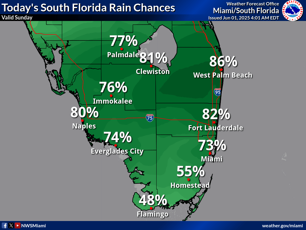
Rain probabilities are high, with Clewiston at 86%, followed by West Palm Beach (86%), Fort Lauderdale (82%), and Naples (80%). Miami’s at 73%, while southern areas like Homestead (55%) and Flamingo (48%) have lower probabilities.
The NWS Miami warns that the combination of high temperatures, significant rain chances, and severe thunderstorms increases the risk of hazards like flash flooding and lightning strikes.
Copyright 2023-2025 FloridaWord.com


