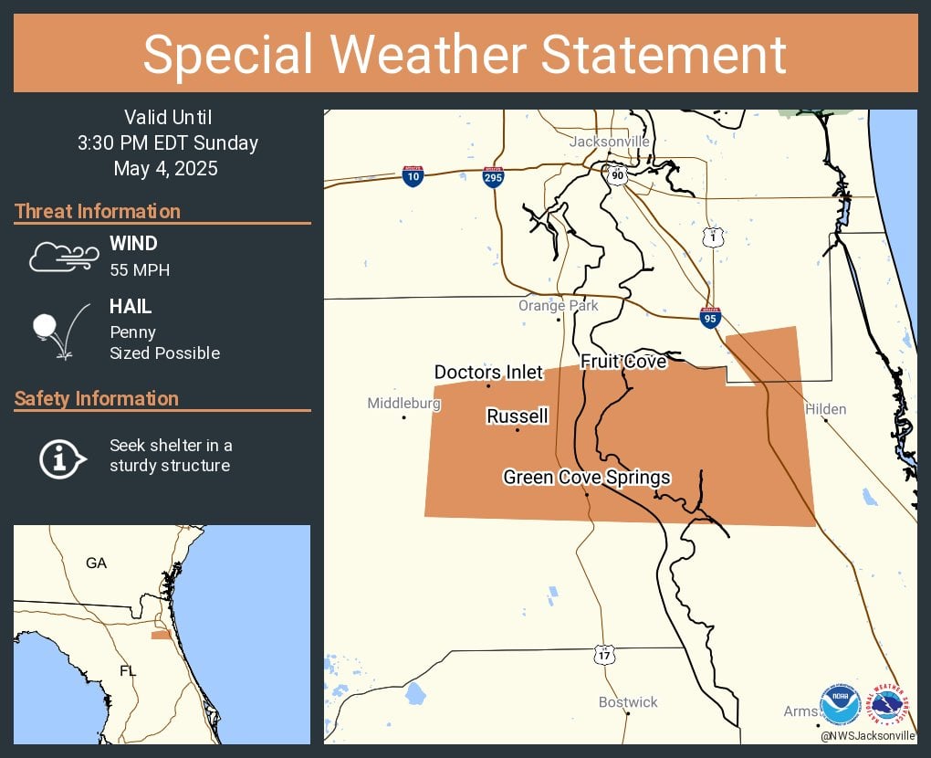
The storm, tracked by Doppler radar, is moving east at 25 mph and poses multiple hazards, including wind gusts of 45 to 55 mph and penny-sized hail.
According to radar data, the storm could produce gusty winds capable of knocking down tree limbs and unsecured objects, with minor hail damage to vegetation possible.
Torrential rainfall may also cause localized flooding, and drivers are urged to avoid flooded roadways.
Frequent cloud-to-ground lightning is occurring, with strikes possible up to 10 miles from the storm’s center, prompting officials to advise seeking shelter in a building or vehicle.
Areas in the storm’s path include Asbury Lake, Fleming Island, Green Cove Springs, Penney Farms, Bayard, Fruit Cove, World Golf Village, and Switzerland. Residents are encouraged to take shelter indoors and stay alert for rapidly changing conditions.