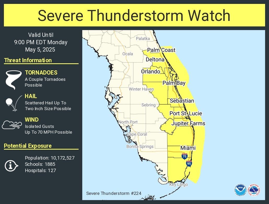
MIAMI, Florida – The National Weather Service (NWS) Storm Prediction Center in Norman, Oklahoma, has issued Severe Thunderstorm Watch 224 for portions of southeast Florida, effective immediately until 9:00 PM EDT on Monday, May 5, 2025.
The NWS warns of several hazards associated with this storm system, including the possibility of a couple of tornadoes, hail up to two inches in diameter, and wind gusts reaching speeds of 70 mph.
The watch, announced at 2:15 PM EDT, covers 16 counties: Brevard, Broward, Indian River, Martin, Miam-Dade, Okeechobee, Orange, Osceola, Palm Beach, Seminole, St. Lucie, and Volusia.
The following major cities are included in the watch: Miami, Orlando, Pembroke Pines, Port Saint Lucie, Fort Lauderdale, Hialeah, and Hollywood.
Storms that produce hailstones the size of quarters or larger can result in dents on cars, damage to roofs, break windows, and can be deadly to animals and people.
Large hailstones can fall at speeds faster than 100 mph.
Copyright 2023-2025 FloridaWord.com

