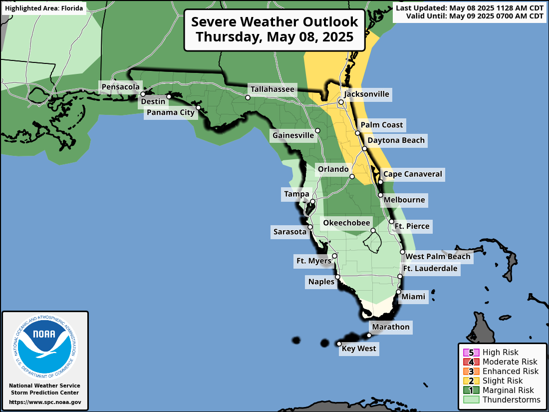
National Weather Service Storm Prediction Center Severe Weather Forecast for Florida Thursday May 8, 2025.
JACKSONVILLE, Florida – The National Weather Service Storm Prediction Center has issued a severe weather outlook for North Florida, highlighting the risk of severe thunderstorms across northeast Florida on Thursday, May 8, 2025. The forecast warns of potentially hazardous conditions continuing through the weekend.
Afternoon and Evening Storm Risks
The NWS Jacksonville office has identified a heightened threat of isolated strong to severe thunderstorms on May 8, 2025, particularly affecting inland Southeast Georgia and the Atlantic coast. Key hazards include:
Damaging winds (40-60 mph), capable of impacting structures and trees.
Hail, posing risks to property and vehicles.
Heavy downpours, which may lead to localized flooding in areas already saturated from recent rainfall.
National Weather Service Jacksonville Severe Weather Forecast for northeast Florida May 8-10, 2025.
According to the National Weather Service in Jacksonville, a stalled front across North Florida will trigger waves of heavy rainfall and isolated severe storms daily through at least Sunday, May 10, 2025.
Storms are expected to intensify each afternoon and evening, especially near and east of the Highway 301 corridor toward the Atlantic coast.
Jacksonville Weather Forecast
Thursday, May 8, 2025
A chance of showers before 2 PM, escalating to likely showers and possible thunderstorms between 2 PM and 5 PM, with showers and thunderstorms likely after 5 PM. Partly sunny, with a high near 86°F. Southwest winds at 5-7 mph. Precipitation chance: 70%. Expected rainfall: 0.25 to 0.5 inches.
Thursday Night
Showers and thunderstorms likely before midnight, followed by a slight chance of showers after 5 AM. Mostly cloudy, with a low around 70°F. Winds shifting from east at 7 mph to southwest after midnight. Precipitation chance: 60%. Additional rainfall: 0.25 to 0.5 inches.
Friday, May 9, 2025
Showers and thunderstorms, mainly after 2 PM. High near 86°F. West winds at 5-7 mph. Precipitation chance: 80%.
Friday Night
Showers and thunderstorms before 8 PM, then likely showers and a possible thunderstorm from 8 PM to 11 PM, followed by likely showers. Low around 70°F. Southwest winds at 5-8 mph, becoming calm. Precipitation chance: 80%.
Saturday, May 10, 2025
Showers and possibly a thunderstorm. High near 81°F. Precipitation chance: 90%.
Saturday Night
Showers likely with a possible thunderstorm. Mostly cloudy, with a low around 69°F. Precipitation chance: 70%.
Sunday, May 11, 2025
Showers and possibly a thunderstorm. High near 80°F. Precipitation chance: 90%.
Sunday Night
Showers and possibly a thunderstorm. Low around 70°F. Precipitation chance: 80%.
Flood Risk
With 4 to 8 inches of rain forecast across much of Southeast Georgia and Northeast Florida through early next week, and localized amounts up to 10 inches possible, the risk of flooding is significant. The NWS has noted a Marginal Risk (Level 1/4) of excessive rainfall through Saturday, increasing to a Slight Risk (Level 2/4) on Sunday and Monday, particularly in areas like Jacksonville. Residents should avoid driving through flooded areas and prepare for potential impacts.