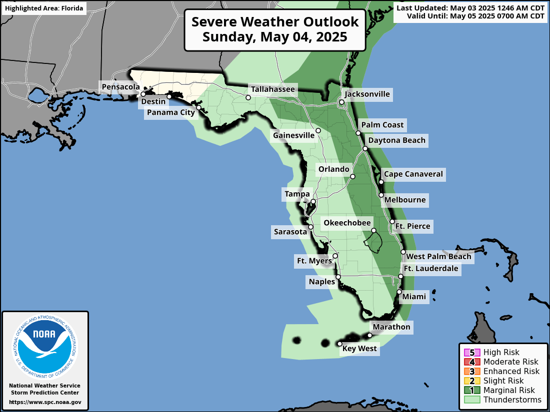
The National Weather Service in Jacksonville forecasts isolated strong to severe thunderstorms across North Florida, especially along the I-95 corridor during the afternoon hours on Sunday, May 4, 2025, from 2 PM to 8 PM as the cold front slowly moves through the area.
The greatest chances of storms will be along coastal locations as the Atlantic sea breezes moves inland and interacts with the frontal boundary.
The shaded area on the map, indicating the severe thunderstorm risk zone, includes the following Florida cities:
Expected hazards include thunderstorms with wind gusts of 40-60 mph, penny to quarter-sized hail, and a very low chance of a brief, isolated tornado near the east coast.
Jacksonville Weather Forecast
Sunday
A chance of showers and thunderstorms before 8am, then a chance of showers between 8am and 11am, then showers likely and possibly a thunderstorm after 11am. Partly sunny, with a high near 84. Southwest wind 9 to 11 mph, with gusts as high as 17 mph. Chance of precipitation is 70%. New rainfall amounts between a quarter and half of an inch possible.
Sunday Night
A 20 percent chance of showers and thunderstorms before 2am. Partly cloudy, with a low around 66. Southwest wind 6 to 9 mph.
Monday
A slight chance of showers between 8am and 2pm, then a chance of showers and thunderstorms after 2pm. Mostly sunny, with a high near 85. West wind 6 to 8 mph. Chance of precipitation is 30%.
Monday Night
A 30 percent chance of showers and thunderstorms before 8pm. Mostly clear, with a low around 65.
Tuesday
Sunny, with a high near 88.
Tuesday Night
Partly cloudy, with a low around 69.
Wednesday
A 20 percent chance of showers and thunderstorms after 2pm. Partly sunny, with a high near 89.
Wednesday Night
A 10 percent chance of showers and thunderstorms before 8pm. Mostly cloudy, with a low around 70.