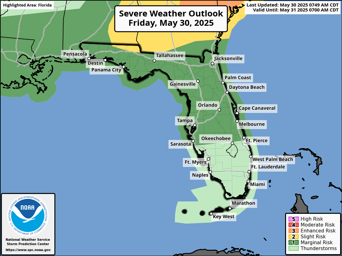
National Weather Service Storm Prediction Center Severe Weather Forecast for Florida Friday May 30, 2025.
ORLANDO, Florida – Showers and thunderstorms will develop early across the I-4 corridor this morning.
By the afternoon, storm activity will shift south of Orlando, with the greatest coverage and intensity expected between 2 PM and 8 PM, according to the National Weather Service in Melbourne.
A dominant westerly sea breeze will push the warmest temperatures and highest heat indices toward the coast.
The National Weather Service Storm Prediction Center has issued a severe storm Outlook for Friday, May 30, 2025.
The NWS warns of the following hazards during the peak storm hours:
The eastern half of Central Florida faces the highest risk of strong to severe storms, with peak intensity expected between 2PM and 8 PM.
Hailstones the size of quarters or larger can:
Hail can fall at speeds exceeding 100 mph, amplifying its destructive potential. Learn more about hail dangers here.
Heat index values will reach 97-102°F this afternoon, with the highest values near the coast. Cities like Orlando, Leesburg, Daytona Beach, Vero Beach, and Port St. Lucie will see highs in the low to mid-90s, with heat indices of 97-100°F.
Today
Showers and thunderstorms likely, mainly before 5pm. Mostly sunny, with a high near 89. Southwest wind around 10 mph, with gusts as high as 20 mph. Chance of precipitation is 60%. New rainfall amounts of less than a tenth of an inch, except higher amounts possible in thunderstorms.
Tonight
A 30 percent chance of showers and thunderstorms, mainly before 7pm. Partly cloudy, with a low around 74. West southwest wind around 10 mph.
Saturday
A 50 percent chance of showers and thunderstorms, mainly before 2pm. Partly sunny, with a high near 86. West wind around 10 mph. New rainfall amounts between a quarter and half of an inch possible.
Saturday Night
Partly cloudy, with a low around 70. West wind 5 to 10 mph.
Sunday
Sunny, with a high near 90. West southwest wind 5 to 10 mph.
Copyright 2023-2025 FloridaWord.com


