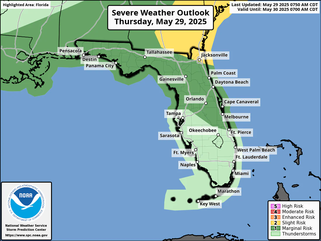
National Weather Service Storm Prediction Center Severe Weather Forecast for Florida Thursday May 29, 2025.
ORLANDO, Florida – Central Florida braces for a stormy afternoon and evening on Thursday, May 29, 2025, with severe weather threats, according to the National Weather Service in Melbourne.
The National Weather Service Storm Prediction Center has issued a severe storm Outlook for Thursday May 29, 2025:
Potential Hazards: Gusty winds (45-55 mph), coin-sized hail up to 1.5 inch in diameter, frequent cloud-to-ground lightning, and local rainfall accumulations of 1-3+”. There is a very low chance for an isolated brief tornado.
The eastern half of Central Florida faces the highest risk of strong to severe storms, with peak intensity expected between 3 PM and 9 PM.
Hailstones the size of quarters or larger can:
Hail can fall at speeds exceeding 100 mph, amplifying its destructive potential. Learn more about hail dangers here.
The NWS forecasts temperatures across Central Florida will climb into the low to mid-90s, with Orlando, Leesburg, and Kissimmee expected to reach 92°F, while coastal areas like Vero Beach and Port St. Lucie will see highs of 90°F and 89°F, respectively.
High humidity levels, ranging from 50% in Port St. Lucie to 70% in Daytona Beach, will push the heat index—a measure of how hot it feels—into the 100-105°F range.
Today
A 30 percent chance of showers and thunderstorms, mainly after 3pm. Mostly sunny, with a high near 93. South southwest wind around 5 mph.
Tonight
Showers and thunderstorms likely, mainly before 8pm. Mostly cloudy, with a low around 75°F. South southwest wind 5 to 10 mph, with gusts as high as 20 mph. Chance of precipitation is 60%. New precipitation amounts between a tenth and quarter of an inch, except higher amounts possible in thunderstorms.
Friday
Showers and thunderstorms likely, mainly after 2pm. Mostly sunny, with a high near 91°F. Southwest wind 5 to 15 mph, with gusts as high as 20 mph. Chance of precipitation is 60%. New rainfall amounts between a tenth and quarter of an inch, except higher amounts possible in thunderstorms.
Friday Night
Showers and thunderstorms likely, mainly before 8pm. Mostly cloudy, with a low around 75°F. West southwest wind around 10 mph, with gusts as high as 20 mph. Chance of precipitation is 60%.
Copyright 2023-2025 FloridaWord.com


