National Weather Service Storm Prediction Center Severe Weather Forecast for Florida Sunday May 4, 2025.
ORLANDO, Florida – Central Florida is set for a wet and stormy weekend, with severe weather threats on Sunday and Monday, according to the National Weather Service in Melbourne.
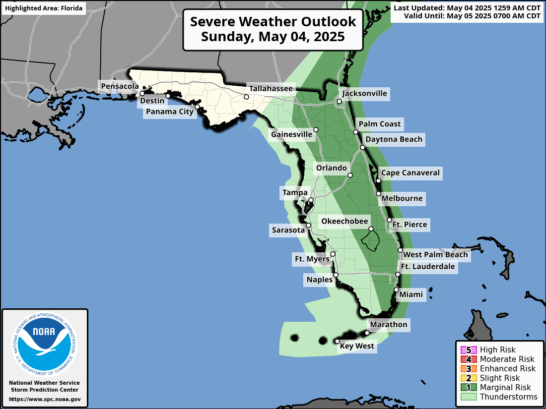
The National Weather Service Storm Prediction Center has issued a severe weather outlook for Central Florida due to the potential for severe thunderstorms, large hail, gusty winds, and tornadoes that are expected to impact the region on Sunday and Monday, May 4-5, 2025.
Storms, some strong to locally severe, will move across northern portions of the area through midday. This afternoon, additional storms are forecast to develop south and east of the Orlando metro. This activity could also produce strong to severe storms, especially along the Treasure Coast.
Severe storms are most likely along the coast in the afternoon, with hazards including damaging wind gusts up to 60 mph, frequent lightning, large hail up to 1 inch in diameter, heavy rainfall (1–2 inches locally), and a low (2–4%) chance of a tornado.
The severe weather threat is expected to subside around sunset inland and by 10 PM near the coast.
Damaging wind gusts up to 60mph, frequent lightning strikes, large hail to 1” in diameter, and heavy rainfall (local amounts to 1-2”) are the main hazards.
There is uncertainty in the exact timing of severe storms; however, the main focus for severe storms will be in the afternoon with scattered to numerous showers and storms (50-70%) forecast, especially along the coast.
Storms that produce hailstones the size of quarters or larger can result in dents on cars, damage to roofs, break windows, and can be deadly to animals and people.
Large hailstones can fall at speeds faster than 100 mph.
Copyright 2023-2025 FloridaWord.com


