National Weather Service Storm Prediction Center Severe Weather Forecast for Florida Wednesday, May 21, 2025.
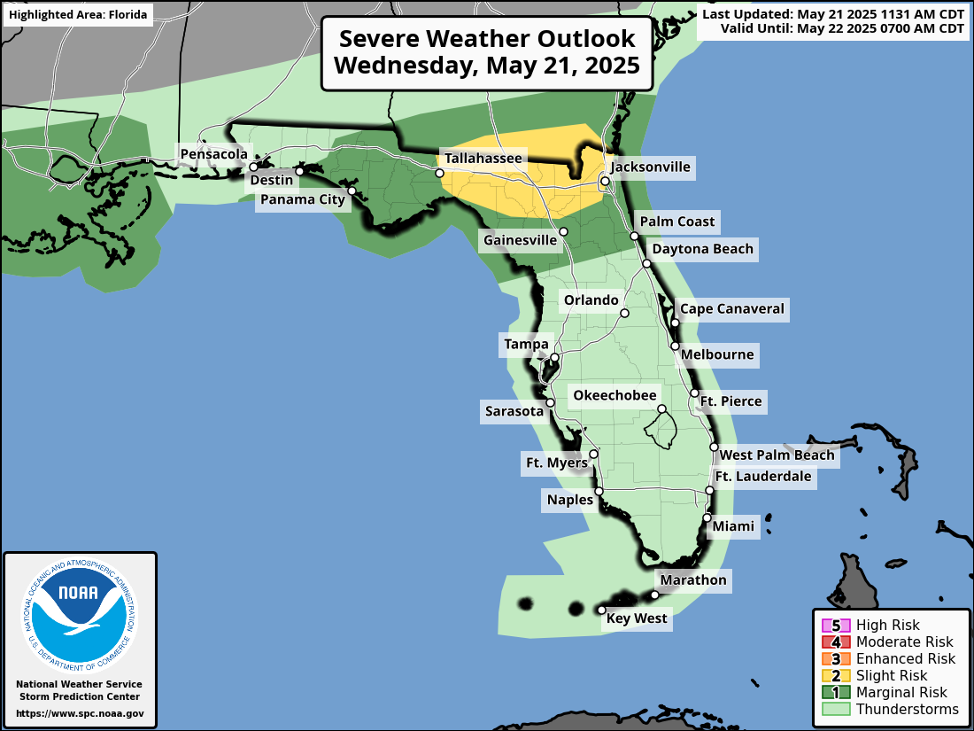
TALLAHASSEE, Florida – The National Weather Service Storm Prediction Center issued a severe weather outlook for the Florida Panhandle and Florida Big Bend due to a Slight Risk (Level 2 of 5) of strong to severe thunderstorms on Wednesday, May 21, 2025.
According to the National Weather Service Tallahassee, a broken line of showers and thunderstorms ahead of a cold front will move from northwest to southeast this morning into this evening.
The primary hazards are gusty (locally damaging) winds and small to medium size hail. A brief tornado or two can’t be ruled out. Heavy rain may also lead to minor poor drainage flooding.
The greatest chance for severe weather is along the I-10 corridor. Florida Panhandle cities at risk for severe weather include:
The rain and cloud coverage will bring some much needed relief to the Florida Panhandle from the excessive heat this week.
Heat indices across the Florida Panhandle will drop from the high 90s on Wednesday to high 80s on Thursday.
Copyright 2023-2025 FloridaWord.com


