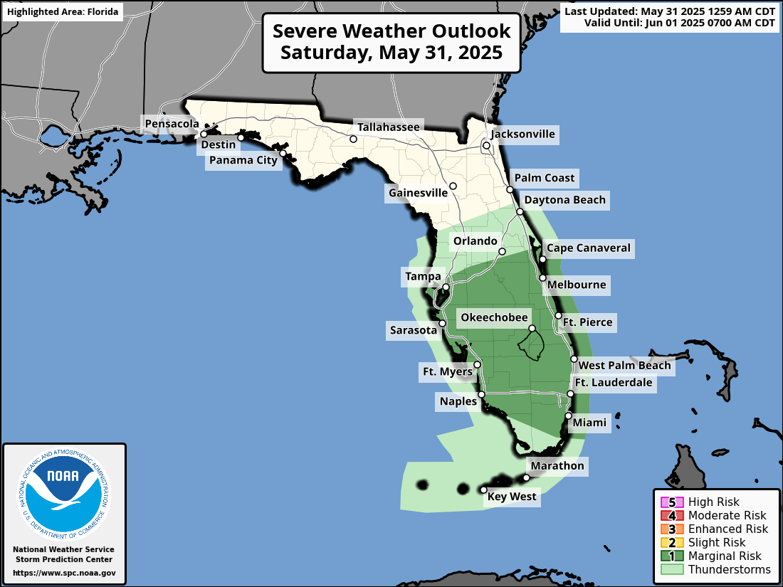
National Weather Service Storm Prediction Center Severe Weather Forecast for Florida Saturday, May 31, 2025.
ORLANDO, Florida – Scattered showers and lightning storms are forecast to push into Lake County, Volusia County, Seminole County, and Orange County early this morning ahead of a cold front, according to the National Weather Service in Melbourne.
These storms will then push southward through the morning and early afternoon.
The stronger storms will be capable of gusty winds, frequent lightning strikes, and heavy rain.
The National Weather Service Storm Prediction Center has issued a Severe Weather Outlook for Saturday, May 31, 2025.
The NWS warns of the following hazards during the peak storm hours:
Hailstones the size of quarters or larger can:
Hail can fall at speeds exceeding 100 mph, amplifying its destructive potential. Learn more about hail dangers here.
Today
Showers and thunderstorms likely, mainly before 2pm. Mostly cloudy, with a high near 85. West wind around 10 mph. Chance of precipitation is 60%. New rainfall amounts between a quarter and half of an inch possible.
Tonight
Mostly clear, with a low around 70. West wind around 5 mph.
Sunday
A 30 percent chance of showers and thunderstorms after 2pm. Sunny, with a high near 88. Calm wind becoming west southwest around 5 mph in the afternoon.
Sunday Night
A chance of showers and thunderstorms before 11pm, then a slight chance of showers between 11pm and 2am, then a chance of showers and thunderstorms after 2am. Partly cloudy, with a low around 72. West wind around 5 mph. Chance of precipitation is 30%.
Monday
A chance of showers and thunderstorms before 8am, then a chance of showers between 8am and 11am, then a chance of showers and thunderstorms after 11am. Partly sunny, with a high near 88. West wind around 5 mph. Chance of precipitation is 50%.
Copyright 2023-2025 FloridaWord.com


