National Weather Service Storm Prediction Center Severe Weather Forecast for Florida Saturday May 10, 2025.
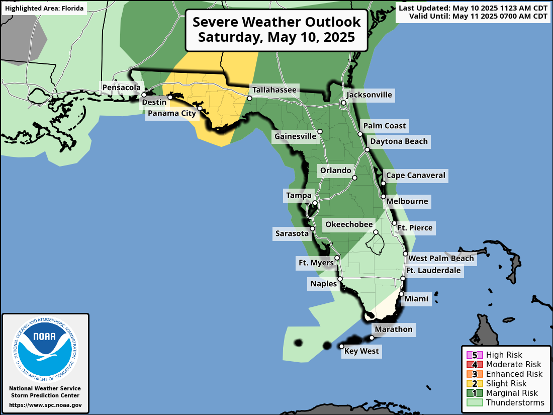
TALLAHASSEE, Florida – The National Weather Service Storm Prediction Center has issued a severe weather outlook for North Florida and the Florida Panhandle due to a Slight Risk (Level 2 of 5) for severe thunderstorms on Saturday, May 10, 2025,
A moist and unstable warm sector over the Northeast Gulf of Mexico is fueling strong storms, which are expected to intensify as they move closer to the coastal Florida Panhandle and Big Bend.
The National Weather Service in Tallahassee forecasts a few strong to severe thunderstorms. Isolated damaging wind gusts are the primary concern, but some hail and a tornado or two cannot be ruled out.
A couple rounds of rain remain possible through the weekend into Monday. An additional 2″ to 6″ of rain is possible in addition to the rain some areas picked up Friday into Friday night. Locally higher amounts of 10″+ remain possible as this storm system crawls through the Southeast over the next 3 days.
A Flood Watch remains in effect through Monday evening.
Excessive runoff may result in flooding of rivers, creeks, streams, and other low-lying and flood-prone locations.
Flooding may occur in poor drainage and urban areas.
Copyright 2023-2025 FloridaWord.com


