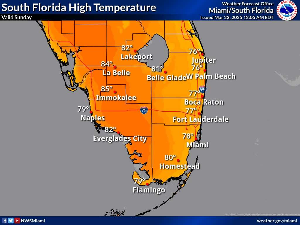
Weather

Wildfire Smoke, Rip Currents, Sunny For South Florida

, Florida – Another warm and mainly dry day across with afternoon highs in the upper 70s to low 80s across on Sunday, March 23, 2025, according to the National Weather Service in Miami. Mostly cloudy tonight with lows in the high 60s.

A High Rip Current Risk is in effect for the Palm Beaches with a moderate risk at the MiamiDade, Broward, and Collier beaches.

There is potential for patchy smoke and decrease in visibility in portions of far southern Miami-Dade and Mainland Monroe Counties due to actively burning wildfires.

South Florida Extended Forecast Monday through Saturday

The rip current risk will be elevated for all southeast Florida beaches through early this week.

There is a slight chance of an isolated thunderstorm for Tuesday and Wednesday with a frontal passage, according to the National Weather Service Storm Prediction Center.

Monday
Mostly sunny, with a high near 80. Southeast wind around 10 mph.
Monday Night
Mostly cloudy, with a low around 72. South wind 5 to 8 mph.
Tuesday
A 30 percent chance of showers, mainly after 2pm. Mostly cloudy, with a high near 80. Light and variable wind becoming east 5 to 7 mph in the afternoon.
Tuesday Night
A 30 percent chance of showers and thunderstorms, mainly before 8pm. Mostly cloudy, with a low around 71. East wind around 6 mph.
Wednesday
A slight chance of showers between 8am and 2pm, then a chance of showers and thunderstorms after 2pm. Mostly sunny, with a high near 80. East wind 5 to 7 mph. Chance of precipitation is 30%.
Wednesday Night
A 30 percent chance of showers and thunderstorms before 8pm. Partly cloudy, with a low around 71. Northeast wind 6 to 8 mph.
Thursday
Sunny, with a high near 80. Northeast wind 8 to 15 mph, with gusts as high as 20 mph.
Thursday Night
Mostly clear, with a low around 72. Breezy.
Friday
Mostly sunny, with a high near 77. Breezy.
Friday Night
Partly cloudy, with a low around 73. Breezy.
Saturday
Mostly sunny, with a high near 78.

Contact Us    Privacy Policy

Copyright 2023-2025 FloridaWord.com