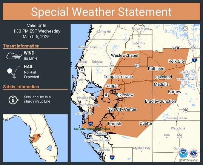
Tampa Bay, FL – The National Weather Service in Ruskin has issued a Special Weather Statement as strong thunderstorms move through parts of the Tampa Bay area this afternoon.
As of 12:26 PM EST on Wednesday, March 5, 2025, Doppler radar indicated a line of strong storms extending from Zephyrhills West to Riverview and Memphis, moving east at 30 mph.
Residents in the affected areas are urged to seek indoor shelter if outdoors. Secure loose objects to prevent wind damage.
Stay tuned to local weather updates for further developments.
Copyright 2023-2025 FloridaWord.com

