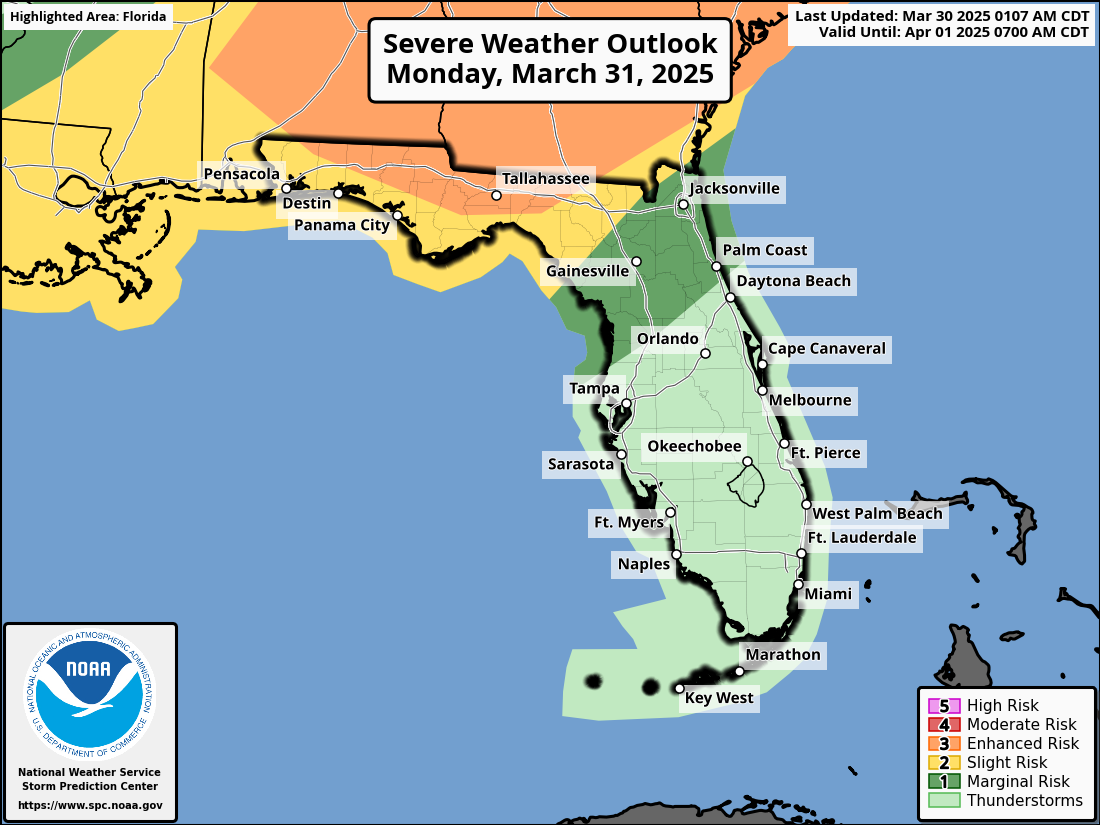
JACKSONVILLE, Florida – The National Weather Service (NWS) in Jacksonville has issued a severe weather forecast for northeast Florida, warning of potentially severe thunderstorms expected to impact the region from Sunday, March 30, through Monday, March 31, 2025.
Residents are urged to prepare for hazardous conditions, including damaging winds, large hail, and the possibility of heavy rain.
According to the NWS forecast, thunderstorms are expected to develop in northeast Florida early Sunday morning, escalating into severe storms by late Sunday morning and continuing through Sunday evening.
The risk of severe weather includes wind gusts of 40 to 60 miles per hour and hail up to 1 inch in diameter, with a low risk of isolated tornadoes.
The NWS Storm Prediction Center has rated this threat as marginal, but residents should remain vigilant due to the potential for localized impacts.
The threat will persist into Monday, with the most significant concerns occurring Monday afternoon and evening. A pre-frontal squall line could bring heavy downpours, potentially causing minor flooding, along with damaging winds capable of causing power outages. The storm system is expected to decrease in intensity by Monday evening as it moves out of the region.
Key potential impacts include power outages, large hail, and localized heavy rainfall that may lead to flash flooding, particularly in urban and low-lying areas with poor drainage.
Storms that produce hailstones the size of quarters or larger can result in dents on cars, damage to roofs, break windows, and can be deadly to animals and people.
Large hailstones can fall at speeds faster than 100 mph.
Copyright 2023-2025 FloridaWord.com


