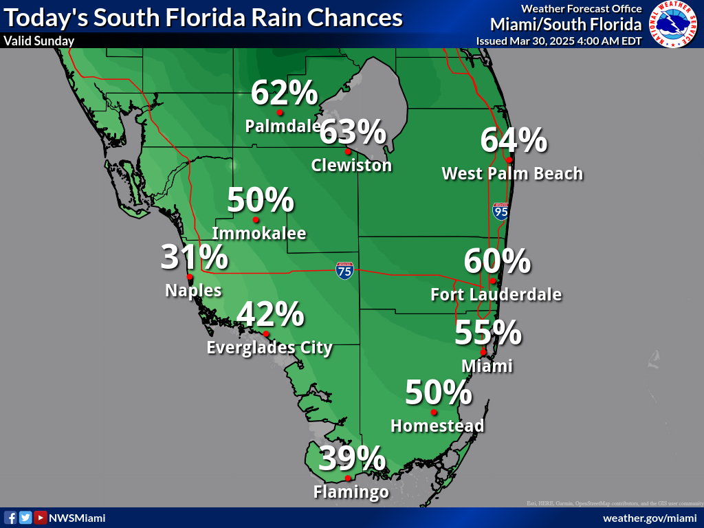
MIAMI, Florida – Scattered thunderstorms will develop this afternoon into this evening across South Florida on Sunday, March 30, 2025,
Some of these storms could become strong to marginally severe containing strong gusty winds up to 60 mph, small hail, and heavy downpours, according to the Nationa Weather Service Storm Prediction Center.
While the bulk of rainfall today is forecast near Lake Okeechobee and inland areas of Palm Beach, Glades and Hendry counties, a prolonged duration of heavy rainfall over an urban area could result in localized flooding this afternoon into this evening, according to the National Weather Service in Miami.
A High Rip Current Risk remains in effect for Miami-Dade, Palm Beach, and Broward counties.
Highs will reach the lower 80s along the east coast, upper 80s along the west coas, and low 90s for inland portions of South Florida.
Isolated to scattered thunderstorms may linger across South Florida on Monday with the strongest storms possibly containing heavy downpours and gusty winds.
An elevated risk of rip currents may persist across the Atlantic Coast beaches on Monday. This risk may increase across the Atlantic Coast beaches towards the middle of the week as onshore flow increase once again.
Copyright 2023-2025 FloridaWord.com