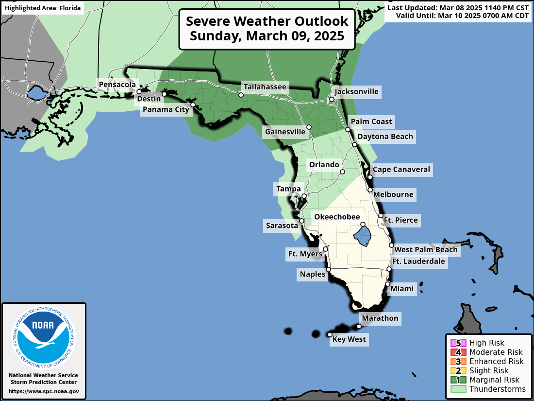
TALLAHASSEE, Florida — There is a scattered complex of showers and thunderstorms across northwest Florida this morning.
A marginal risk (level 1 of 5) for severe storms will continue today and tonight on Sunday, March 9, 2025, across the Florida Panhandle and Big Bend, according to the National Weather Service Storm Prediction Center.
According to the National Weather Service Tallahassee, the primary hazards are isolated damaging winds and large hail, as well as a brief tornado or two. Heavy rain with amounts 2 to 4 inches could lead to isolated flash flooding.
Storms that produce hailstones the size of quarters or larger can result in dents on cars, damage to roofs, break windows, and can be deadly to animals and people.
Large hailstones can fall at speeds faster than 100 mph.
Copyright 2023-2025 FloridaWord.com


