

JACKSONVILLE and TALLAHASSEE, Florida – An approaching cold front will bring high rain chances, severe lightning storms, and possible tornadoes across North Florida, according to the National Weather Service‘s Storm Prediction Center.

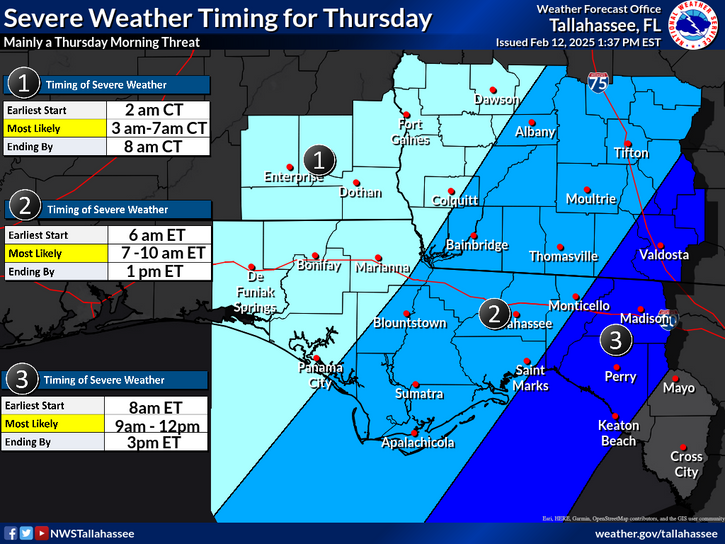
A line of strong to severe thunderstorms will move through Southeast Alabama and the Florida Panhandle during the early morning hours of Thursday, which will move into Southwestern Georgia and the Florida Big Bend region as we move later into the morning. Storms will weaken midday as they approach the I-75 corridor and the Suwannee Valley.
⚡️ Marginal risk of severe thunderstorms today for the Suwannee Valley north into southeast GA! 🌩️ Stay alert for possible strong winds, an isolated tornado, and heavy downpours. 🌬️🌧️
Remember to secure loose outdoor items and have a plan in place in case of severe weather! pic.twitter.com/7jZRJXmMAa
— NWS Jacksonville (@NWSJacksonville) February 13, 2025