JACKSONVILLE, Florida – The National Weather Service (NWS) in Jacksonville, Florida has issued multiple weather alerts for Northeast Florida and Southeast Georgia, including a Severe Thunderstorm Watch, Wind Advisory, and Rip Current Statement.
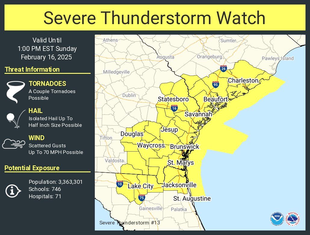
The NWS Storm Prediction Center in Norman, Oklahoma, has placed several Florida counties under a Severe Thunderstorm Watch until 1:00 PM EST. The affected counties include Baker, Columbia, Duval, Hamilton, Nassau, and Suwannee. Residents in these areas should remain vigilant for possible severe thunderstorms capable of producing damaging winds and heavy rainfall.
A Wind Advisory remains in effect from 7:00 AM to 6:00 PM EST today for portions of Northeast and Northern Florida and Southeast Georgia. The advisory warns of southwest winds ranging from 20 to 30 mph, with gusts up to 45 mph. These strong winds may cause unsecured objects to be blown around, potentially knocking down tree limbs and leading to power outages. Motorists, particularly those driving high-profile vehicles, are advised to exercise caution on the roads.
A High Rip Current Risk is in effect through this afternoon along the beaches of Southeast Georgia and Northeast Florida. Dangerous rip currents and rough surf conditions pose a significant hazard to swimmers. The NWS urges beachgoers to swim near a lifeguard and avoid venturing too far from shore. If caught in a rip current, individuals should remain calm, float, and attempt to swim parallel to the shore until they can escape the current.
Copyright 2023-2025 FloridaWord.com

