Isolated Showers, Dangerous Rip Currents For South Florida
Published by
FLORIDA WORD
February 26, 2025 5:30 am
Share
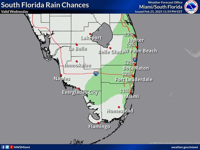
MIAMI, Florida – Sunny skies with a chance of showers, mainly across the eastern half of South Florida on Wednesday, February 26, 2025, according to the National Weather Service in Miami.
A High Rip Current Risk remains in effect through Wednesday evening for Miami-Dade, Palm Beach, and Broward counties.
Highs will range from the mid-70s along the east coast to the upper 70s along the west coast.
Tonight: Partly cloudy with a slight chance of showers before 2 a.m., followed by another slight chance after 3 a.m. Lows around 70°F. East wind around 7 mph. Chance of precipitation: 20%.
Thursday, February 27 Mostly sunny with a high near 77°F. Southeast winds around 7 mph will shift to southwest in the morning.
Thursday Night: Partly cloudy with a low around 65°F. South winds of 6–8 mph will turn northwest after midnight.
Friday, February 28 Mostly sunny with a high near 76°F. Northwest winds of 6–8 mph will shift northeast in the afternoon.
Friday Night: Mostly clear with a low around 67°F. East winds around 6 mph will calm after midnight.
Saturday, March 1 Mostly sunny with a high near 77°F. Light, variable winds will become southeast around 6 mph in the afternoon.
Saturday Night: Partly cloudy with a low around 65°F. South winds around 6 mph will shift northwest after midnight.