

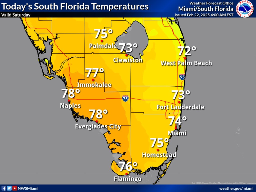
MIAMI, Florida — A 20 percent chance of showers before 9am with temperatures in the low 70s. Partly sunny skies across South Florida on Saturday, February 22, 2025, according to the National Weather Service (NWS) in Miami. An east wind of 11 to 14 mph may bring gusts up to 18 mph.
High Rip Current Risk Beachgoers should exercise caution as there is a high risk of rip currents—exceeding 50%—along the Atlantic beaches today. However, marine conditions are expected to gradually improve through the weekend.

Tonight’s Conditions Saturday night will see mostly cloudy skies with a low around 67 degrees. Winds will shift from east to north at 5 to 9 mph after midnight.
Sunday Through Friday
The chance of thunderstorms will increase during the early portion of the week as a disturbance from the Gulf approaches the region. The potential for heavy rainfall and localized flooding will also increase on Monday into Monday night.
Sunday will bring mostly sunny skies and a high near 76 degrees, with a north wind shifting east later in the day. A slight chance of showers (20%) will develop after 1 a.m. Monday morning, with partly cloudy conditions and a low around 70 degrees.
Showers are likely Monday, with thunderstorms possible in the afternoon. Some storms may bring heavy rainfall, increasing the risk of localized flooding. Monday’s high will be near 75 degrees, with a southeast wind at 8 to 10 mph. The chance of precipitation stands at 70%.
Monday night will remain wet, with a 60% chance of showers and thunderstorms before 1 a.m., followed by lingering rain chances into the early morning. Overnight lows will hover around 66 degrees as winds shift from east to southwest.
Tuesday will see partly sunny skies and a high near 75, with a 30% chance of showers and potential thunderstorms. Nighttime conditions will clear up, with a low around 65 degrees and a gentle north wind.
Wednesday through Friday will bring sunnier and drier conditions. Expect highs in the mid-to-upper 70s and mostly clear nights with temperatures dipping into the mid-to-upper 60s. A slight chance of showers returns Thursday night, but overall, the latter half of the week will be pleasant.