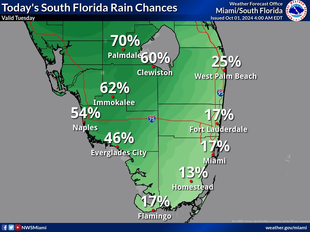
MIAMI, Florida – Isolated to scattered thunderstorms will develop in the afternoon across South Florida on Tuesday, October 1, 2024, with the highest chances remaining over the Lake Okeechobee region as well as Collier County.
The strongest storms could contain gusty winds, frequent lightning, and heavy downpours, according to the National Weather Service Storm Prediction Center.
Isolated waterspouts are possible today across South Florida waters.
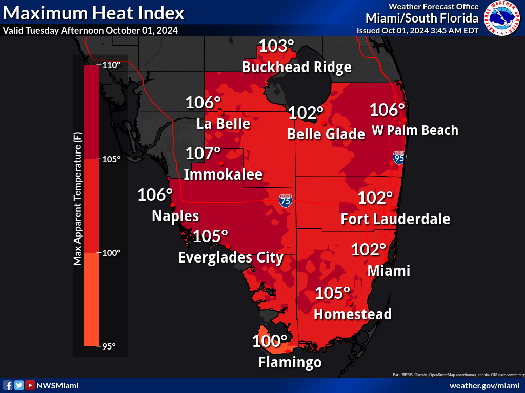
Thunderstorms may bring relief to some areas from the excessive heat where peak heat indices of 102 to 109 degrees will be possible today across most of South Florida, with higher values expected across the western and interior portions.
Wednesday through Monday
Isolated to scattered thunderstorms may develop through the week, with activity expected to increase towards the end of the week.
Heat indices may range from 105 to 110 degrees through the week, though perhaps a few degrees below recent observations.
Nevertheless, heat advisories may be necessary.
A moderate to high risk for rip currents could develop along the east coast later this week as onshore flow becomes prominent.
Copyright 2023-2025 FloridaWord.com