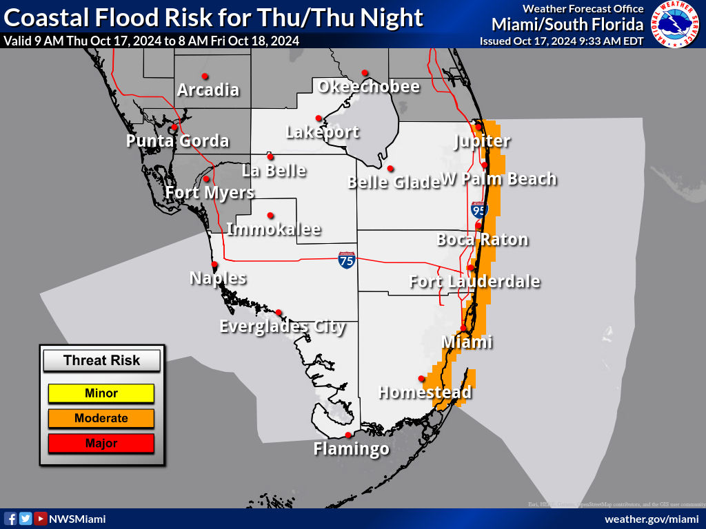
MIAMI, Florida – The National Weather Service in Miami has issued a Coastal Flood Advisory for South Florida that is in effect until 8 p.m. on Saturday.
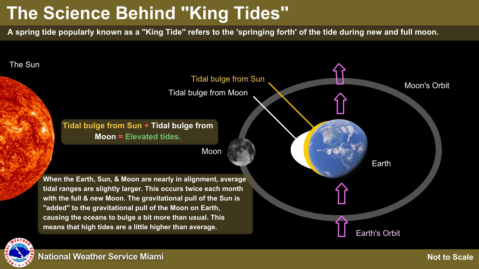
The risk for minor to moderate coastal flooding near times of enhanced astronomical high tides (King tides) around October’s Full Moon will be possible from Thursday into early next week for Palm Beach, Broward, Collier, Monroe, and Miami-Dade counties.
Flooding of low-lying parking lots, coastal roads, and parks may occur around periods of high tide. DO NOT park your vehicle in low-lying areas, as saltwater is corrosive and may damage vehicles.
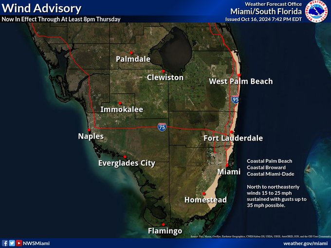
A Wind Advisory has also been issued for Coastal Palm Beach, Coastal Broward, and Coastal Miami-Dade counties through at least 8 p.m. Thursday.
Wind gusts of 30-35 mph are possible today along the Atlantic coast.
There is also a High Rip Current Risk for Palm Beach, Miami-Dade, and Broward counties until 8 p.m. Saturday.
Temperatures this morning are feeling very refreshing thanks to the cold front that passed through yesterday. Highs today will only reach the upper 70s to low 80s across South Florida Most of the area will be rain-free with breezy east-northeast winds.
Friday through Wednesday
Coastal flooding is possible across portions of coastal South Florida the rest of this week due to elevated water levels in conjunction with King Tides.
Hazardous marine conditions expected to continue at all coastal waters behind a cold frontal passage.
Gusty winds not associated with thunderstorms will be possible late in the week and into the weekend.
Copyright 2023-2025 FloridaWord.com