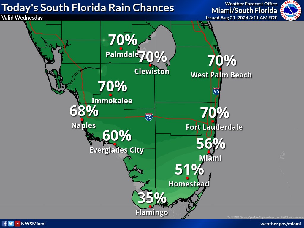
MIAMI, Florida – Scattered thunderstorms could bring gusty winds up to 50 mph, frequent lightning, and heavy downpours this afternoon across South Florida on Wednesday, August 21, 2024, according to the National Weather Service Storm Prediction Center.
Slow moving thunderstorms combined with the potential for heavy downpours could lead to localized flooding.
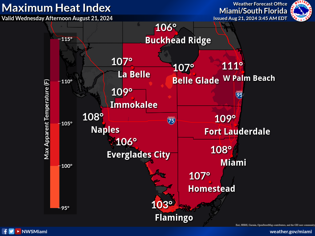
The thunderstorms may bring relief to some areas from the excessive heat where peak heat indices from 105 to 111 degrees are expected.
The National Weather Service in Miami has issued a Heat Advisory is in effect from 10 a.m. to 6 p.m. for Palm Beach, Miami-Dade, and Broward counties.
Thursday through Tuesday
Scattered to numerous thunderstorms will be possible through the end of the week as a trough deepens along the east coast. Some thunderstorms could be strong to marginally severe Thursday and Friday.
A tropical wave will bring enhanced moisture over South Florida this weekend, which will present flooding concerns where showers and thunderstorms repeatedly develop.
Heat indices over 100 degrees up to around 108 degrees are likely through the weekend and into early next week, though the increased rainfall should limit heat advisory chances.
Copyright 2023-2025 FloridaWord.com