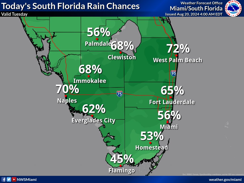
MIAMI, Florida – Scattered to numerous thunderstorms could bring gusty winds up to 50 mph, frequent lightning, and heavy downpours from late morning through the afternoon across South Florida on Tuesday, August 20, 2024, according to the National Weather Service Storm Prediction Center.
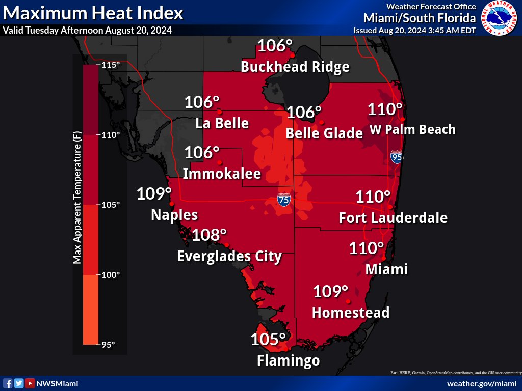
The thunderstorms may bring relief to some areas from the excessive heat where peak heat indices from 105 to 109 degrees are expected.
The National Weather Service in Miami has issued a Heat Advisory is in effect from 10 a.m. to 6 p.m. for Palm Beach, Miami-Dade, and Broward counties.
A high risk of rip currents will continue along the Atlantic beaches off of Palm Beach County.
Minor coastal flooding is possible along the Gulf Coast during high tide cycles today in Collier and Monroe counties.
A few waterspouts cannot be ruled out across South Florida waters.
Wednesday through Monday
Scattered to numerous thunderstorms will be possible each day. The strongest storms could produce gusty winds, frequent lightning, and heavy downpours.
Slow storm motions could also result in localized flooding, particularly near the metro areas.
Heat indices could approach or exceed advisory level criteria during the early to middle portion of the week as they will range between 105 and 110 across most areas.
An elevated risk for rip currents will continue for the Palm Beaches for most of the week due to a lingering swell.
Copyright 2023-2025 FloridaWord.com