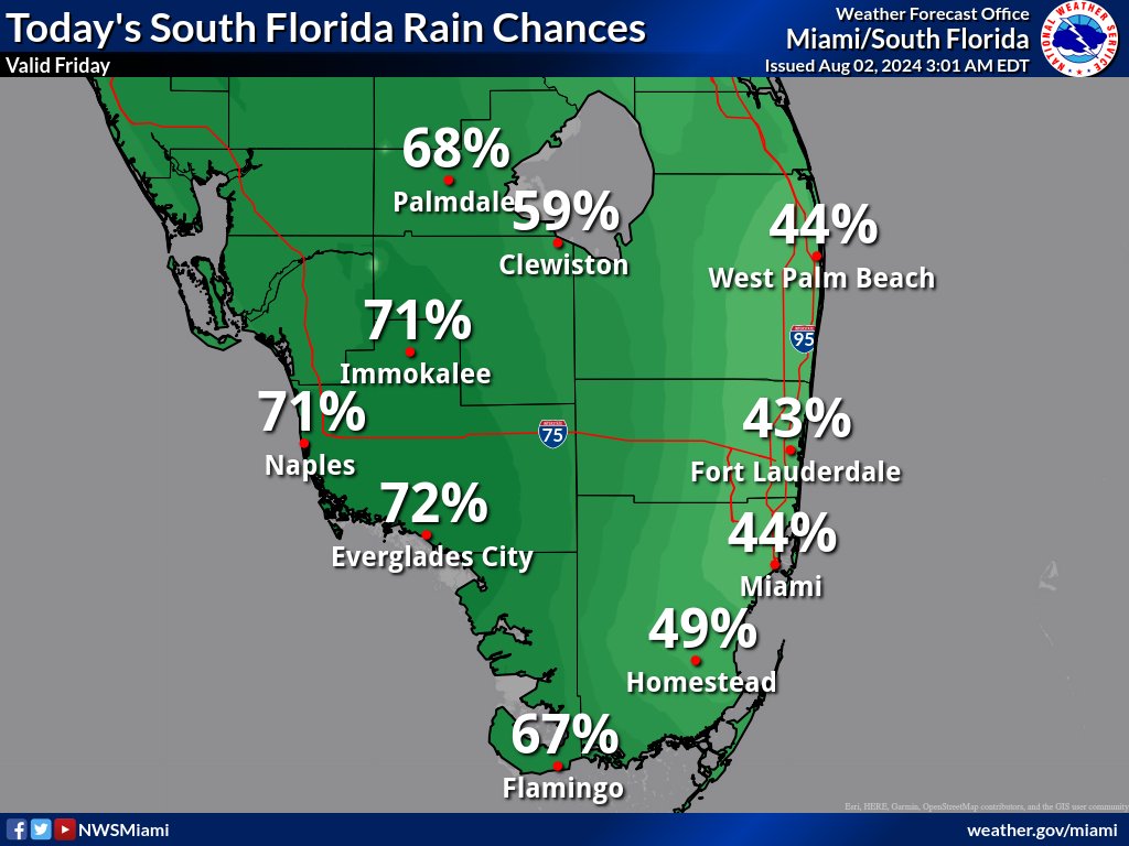
MIAMI, Florida – Scattered to numerous showers and thunderstorms are expected for South Florida during the afternoon and evening on Friday, August 2, 2024.
The greatest chances for storms are over Southwest Florida and the interior portions of South Florida.
The strongest storms could contain gusty winds, frequent lightning, and heavy downpours, that could cause flooding, mainly over portions of Southwest Florida, according to the National Weather Service Storm Prediction Center.
Showers and thunderstorms may bring relief from the excessive heat to some areas of South Florida where peak heat indices between 105 and 110 degrees are expected.
A Heat Advisory is in effect for Miami-Dade, Palm Beach, Collier, Monroe, and Broward counties from 10 a.m. to 7 p.m.
Saturday through Thursday
Rain chances will increase heading into the upcoming weekend as Potential Tropical Cyclone 4 approaches the region.
The strongest storms could produce gusty winds and heavy downpours. Multiple rounds of heavy downpours could create the potential for localized flooding on Saturday and Sunday.
Minor to moderate coastal flooding will be possible on Sunday during the high tide cycle along the Gulf Coast and the southern portion of the peninsula along Florida Bay.
Hazardous marine conditions could develop over the Atlantic and Gulf waters during the upcoming weekend as winds and seas increase.
A high risk of rip currents will develop across the Atlantic Coast beaches this weekend. A high risk of rip currents will also develop along the Gulf Coast beaches towards the second half of the weekend.
Copyright 2023-2025 FloridaWord.com