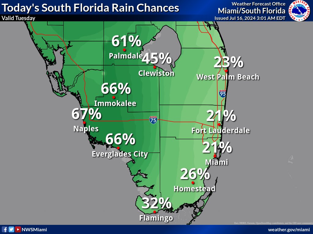
MIAMI, Florida – Scattered thunderstorms will develop in the afternoon across South Florida on Tuesday, July 16, 2024, with the highest chances towards the Gulf coast areas and interior portions of South Florida.
There is a stark contrast between Southeast and Southwest Florida in rain chances today as Saharan dust approaches from the east and intrudes some drier air from east to west today. This drier air will progress slowly and likely not reach the Gulf coast areas before showers and storms form.
The strongest storms could contain gusty winds, frequent to excessive lightning, and heavy downpours, according to the National Weather Service Storm Prediction Center.
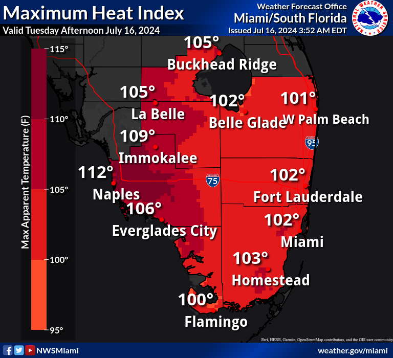
Showers and thunderstorms may bring relief to some areas from the excessive heat where triple digit heat indices are expected across South Florida, primarily in the 100-105 degree range.
The exception will be for Collier County, where heat indices could reach as high as 108-110 degrees. A Heat Advisory has been issued for Collier County from 10 a.m. to 6 p.m.
Wednesday through Monday
Scattered thunderstorms will continue to be possible each day the rest of the week and this upcoming weekend. The strongest storms could produce gusty winds, frequent lightning, and heavy downpours.
Heat indices could continue to rise to near or in excess of advisory thresholds each day the rest of the week and this weekend.
An elevated risk of rip currents is possible several days this week.
Copyright 2023-2025 FloridaWord.com