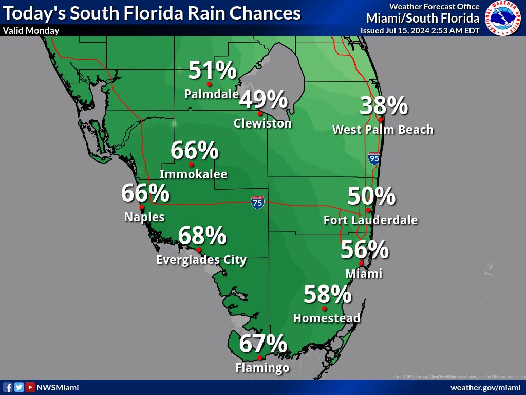
MIAMI, Florida – Scattered thunderstorms will develop in the afternoon across South Florida on Monday, July 15, 2024, with the highest chances remaining over the southwest region in Collier County.
The strongest storms could contain gusty winds up , frequent to excessive lightning, and heavy downpours, according to the National Weather Service Storm Prediction Center.
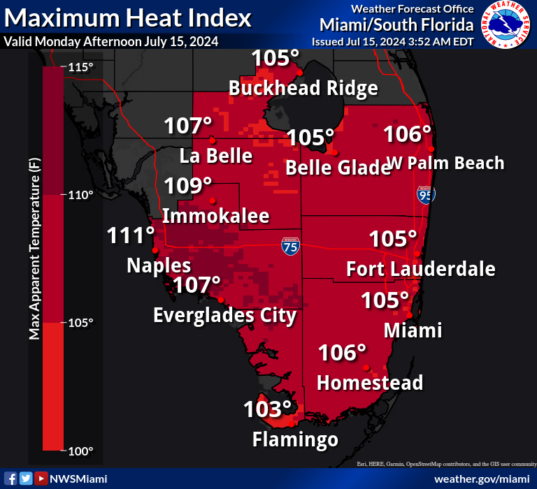
Showers and thunderstorms may bring relief to some areas from the excessive heat where peak heat indices of 103 to 111 degrees will be possible today across most of South Florida, with higher values expected across the western and interior portions.
A Heat Advisory is in effect for Miami-Dade, Collier, Palm Beach, Glades, Hendry, mainland Monroe, and Broward counties from 10 a.m. to 6 p.m.
Tuesday through Saturday
Scattered to numerous thunderstorms will be possible through the week and into early next weekend. The strongest storms could produce gusty winds, frequent lightning, and heavy downpours.
Slow storm motions could result in localized flooding, particularly near the metro areas.
Heat indices in excess of 100 degrees, up to around 110 degrees, are likely into early next week.
An elevated risk of rip currents may persist along the east coast through the weekend and into early next week with a persistent east to southeast onshore flow.
Copyright 2023-2025 FloridaWord.com