
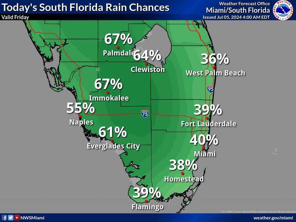
MIAMI, Florida – Scattered to numerous thunderstorms will develop across South Florida on Friday.
The strongest storms could contain gusty winds, frequent to excessive lightning, and heavy downpours., according to the National Weather Service Storm Prediction Center.

Slow moving storms with heavy downpours could result in localized flooding, particularly along the east in Broward County, Palm Beach County, and Miami-Dade County; and along the west coast in Collier County.
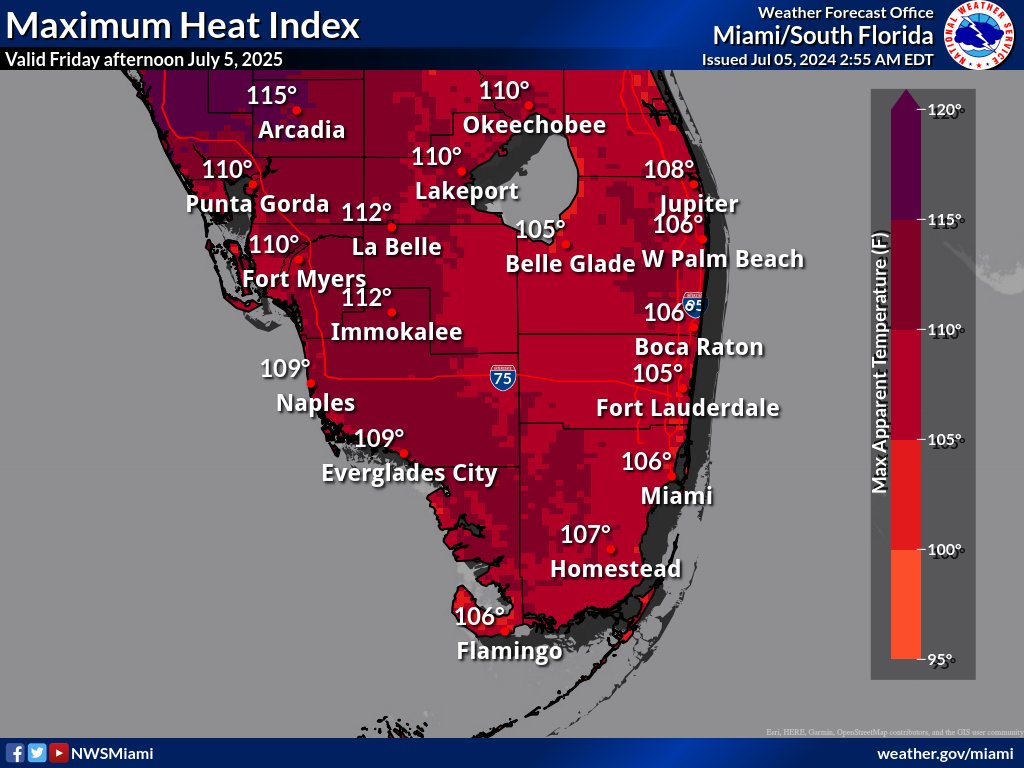
Peak heat indices between 105 and 110 degrees wil be possible today over southeast Florida with peak heat indices between 108 and 113 degrees over southwest Florida. A heat advisory is in effect for the entire area through 8 PM.
Saturday through Thursday
Scattered to numerous thunderstorms will be possible each day through most of the week. The strongest storms could produce gusty winds and heavy downpours. Slow storm motions could also result in localized flooding.
Heat indices over 100 degrees will be possible each day across South Florida through most of the week.