
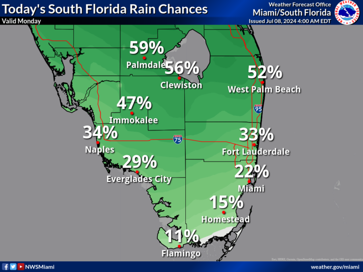
MIAMI, Florida – Scattered thunderstorms will develop in the afternoon across South Florida on Monday.
The strongest storms could contain gusty winds, frequent to excessive lightning, and heavy downpours, according to the National Weather Service Storm Prediction Center.

Slow moving storms with heavy downpours could result in localized flooding.
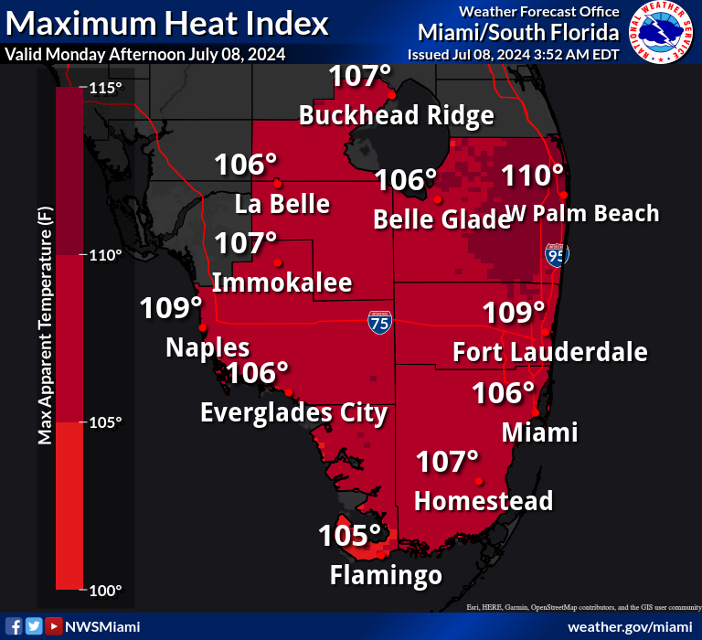
Thunderstorms may bring relief to some areas from the excessive heat where peak heat indices over 100 degrees will be possible today across South Florida.
A Heat Advisory is in effect from 10 a.m. until 6 p.m. for Miami-Dade, Broward, Palm Beach, Collier, Hendry, Glades, and Mainland Monroe Counties
A moderate risk of rip currents will remain in place for Palm Beach County.
Tuesday through Sunday
Scattered to numerous thunderstorms will be possible each day through the rest of the weekend and through most of the week. The strongest storms could produce gusty winds and heavy downpours. Slow storm motions could also result in localized flooding, particularly near the metro areas.
Heat indices over 100 degrees will be possible each day across South Florida through most of the week.