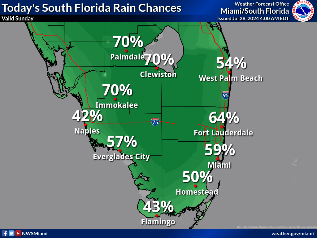
MIAMI, Florida – Numerous to widespread showers and thunderstorms are expected across South Florida during the afternoon and evening on Sunday, July 28, 2024.
The strongest storms could contain gusty winds, frequent lightning, and heavy downpours that could cause isolated flooding, according to the National Weather Service Storm Prediction Center.
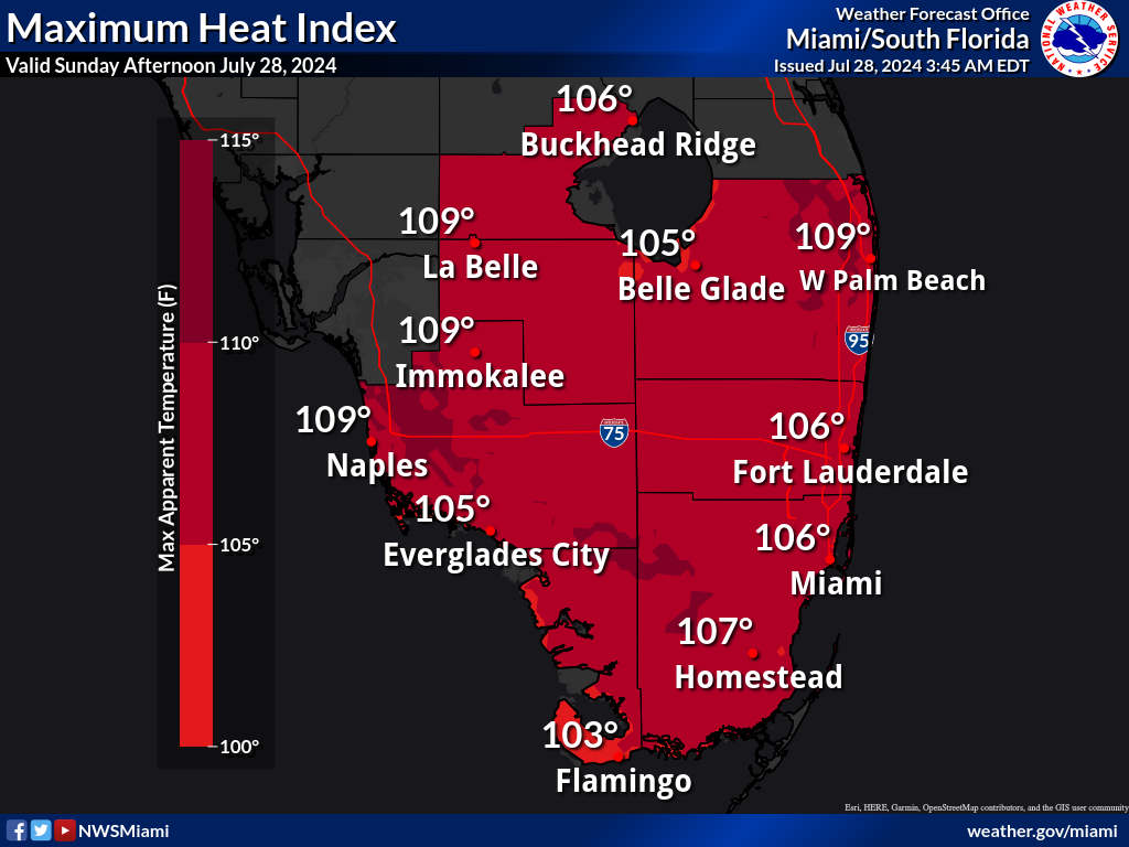
Showers and thunderstorms may bring relief from the excessive heat to some areas of South Florida where peak heat indices between 104 and 109 degrees can be expected.
A Heat Advisory is in effect for Miami-Dade, Palm Beach, and Broward counties from 10 a.m. to 7 p.m.
Monday through Saturday
Scattered to numerous thunderstorms will be possible each day from Monday through Saturday as a system that may form into a tropical cyclone nears Florida.
The strongest storms could produce gusty winds, frequent lightning, and heavy downpours. The greatest threat of heavy rain and potential flooding will likely be early next week.
Heat indices will remain near or above advisory thresholds each day through early next week.
Copyright 2023-2025 FloridaWord.com