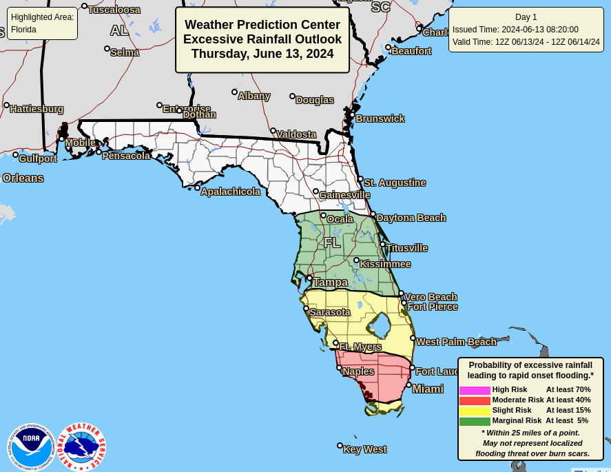
MIAMI, Florida – Scattered to numerous thunderstorms produced by Invest 90L will continue today and tonight, on Thursday, June 13, 2024, across South Florida, Central Florida, and the North Florida peninsula, according to the National Weather Service Hazardous Weather Outlook.
Stronger storms will be capable of producing gusty winds of 40 mph, occasional cloud-to-ground lightning, and torrential downpours that can cause localized flash flooding and ponding on roadways.
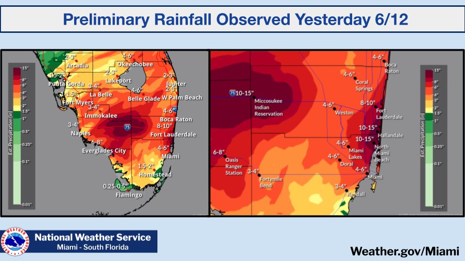
These thunderstorms are forecast to bring excessive rainfall to the southern half of the Florida peninsula where record rainfall amounts of up to 10-15 inches have already accumulated in parts of South Florida.
Florida Governor Ron DeSantis declared a State of Emergency yesterday due to the flooding in South Florida.
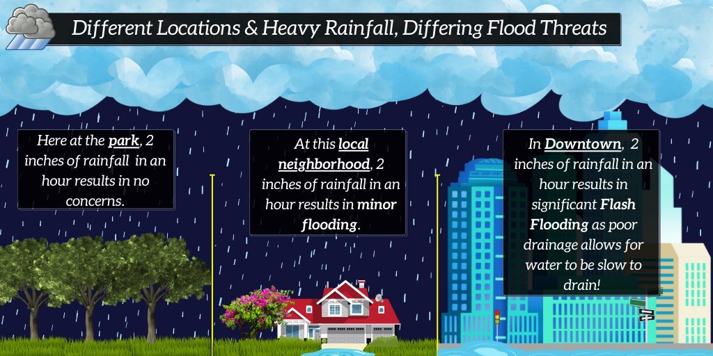
The same amount of rainfall in a short duration of time can cause widely different impacts depending on where it falls.
For example, urban areas such as Downtown Miami and Miami Beach have lower thresholds for flooding due to the built environment and drainage patterns.
Copyright 2023-2025 FloridaWord.com