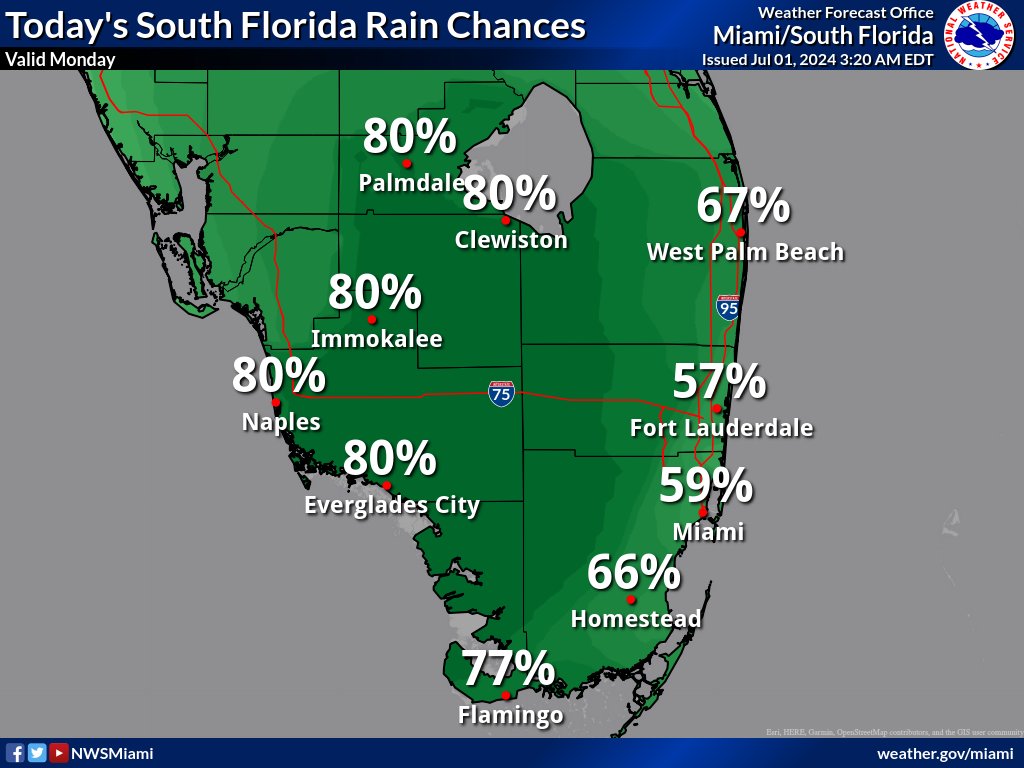
MIAMI, Florida – Scattered to numerous thunderstorms will develop Monday, mainly this afternoon and evening with a focus over Southwest Florida and inland South Florida. The strongest storms could contain gusty winds, frequent to excessive lightning, and heavy downpours., according to the National Weather Service Storm Prediction Center.
Isolated waterspout activity is possible across South Florida waters.
Slow moving storms with heavy downpours could result in localized flooding, particularly along the east in Broward County, Palm Beach County, and Miami-Dade County; and along the west coast in Collier County.
Heat indices in excess of 100 degrees are forecast across South Florida.
Tuesday through Sunday
Scattered to numerous thunderstorms will be possible each day through most of the week. The strongest storms could produce gusty winds and heavy downpours. Slow storm motions could also result in localized flooding.
Heat indices over 100 degrees will be possible each day across South Florida through most of the week.
An elevated risk of rip currents may return to the Atlantic beaches towards the middle of the week as onshore flow increases.
RELATED:
Copyright 2023-2025 FloridaWord.com