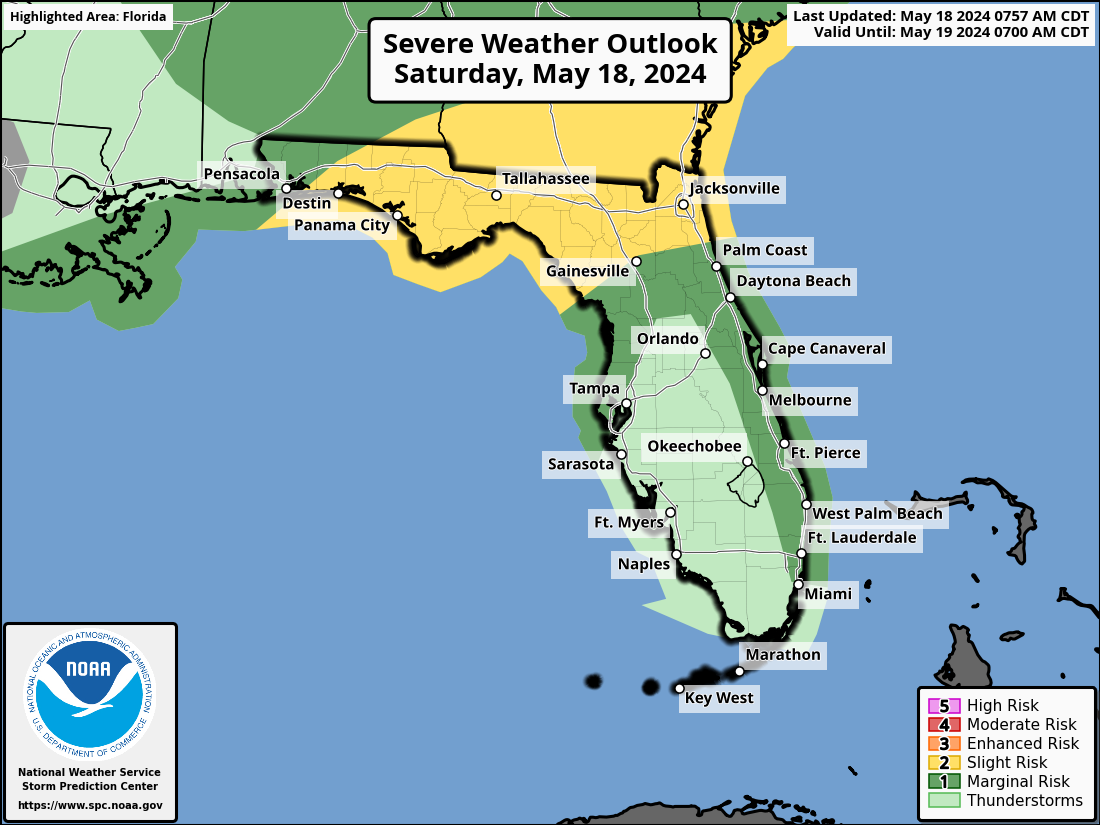
TALLAHASSEE, Florida – Strong to locally severe thunderstorms, capable of producing brief tornadoes, damaging wind gusts, hail, flooding, and frequent lightning will be possible across North Florida from the Panhandle to Jacksonville to Gainesville today, according to the the National Weather Service Storm Prediction Center, with the greatest chance for severe weather occurring from Pensacola to Tallahassee.
A marginal risk for severe weather extends along Florida’s east coast from Jacksonville to Miami.
A FLOOD WATCH is in effect through this evening for the following Florida counties:
Calhoun, Central Walton, Coastal Bay, Coastal Franklin, Coastal Gulf, Coastal Jefferson, Coastal Wakulla, Gadsden, Inland Bay, Inland Franklin, Inland Gulf, Inland Jefferson, Inland Wakulla, Leon, Liberty, South Walton and Washington.
Copyright 2023-2025 FloridaWord.com

