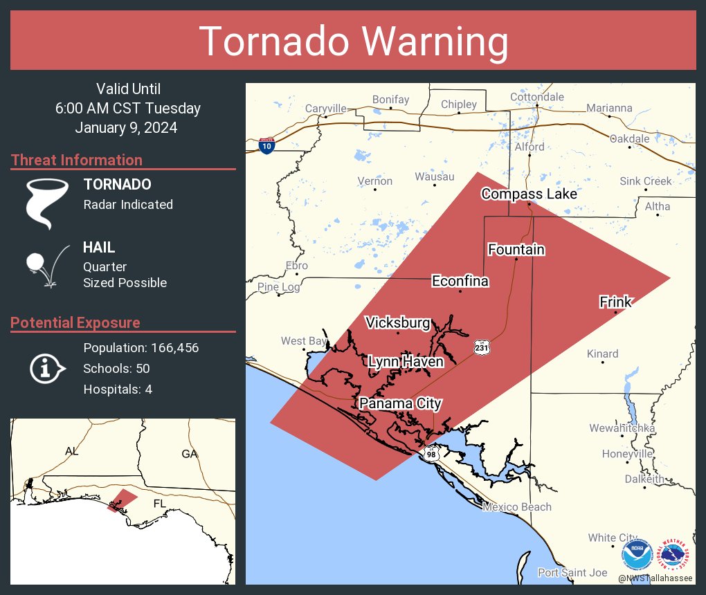
PANAMA CITY, Florida – The National Weather Service in Tallahassee, Florida has issued a tornado warning for southwestern Jackson County, Bay County, northwestern Calhoun County, and southeastern Washington County that will remain in effect until 6:00 a.m. Central Standard Time.
At 5:21 AM CST, a severe thunderstorm capable of producing a tornado was detected approximately 9 miles south of Panama City Beach, moving northeast at a rapid pace of 70 mph.
The thunderstorm is forecast to reach Panama City and Panama City Beach around 5:25 AM CST, with Lynn Haven, Springfield, Hiland Park, and Tyndall Air Force Base expected to be affected by 5:30 AM CST.
Additional locations at risk from this tornadic thunderstorm include Moose Pond, Clarksville, St .Andrews State Park, Southport, Fountain, Cedar Grove, Singer Road, Dirego Park, Beacon Beach, and College Station.
The storm poses a dual threat, with the potential for tornado formation and quarter-size hail.
The impact of the storm is expected to bring flying debris, posing a significant danger to those caught without proper shelter.
Mobile homes are at risk of damage or destruction, and there is a high likelihood of damage to roofs, windows, vehicles, and trees.
The dangerous storm is predicted to reach Panama City and Panama City Beach around 5:25 AM CST, with Lynn Haven, Springfield, Hiland Park, and Tyndall Air Force Base expected to be affected by 5:30 AM CST.
Additional locations at risk from this tornadic thunderstorm include Moose Pond, Clarksville, St Andrews State Park, Southport, Fountain, Cedar Grove, Singer Road, Dirego Park, Beacon Beach, and College Station.
Residents in the warned areas are strongly advised to take immediate precautions. Seek shelter in a basement or an interior room on the lowest floor of a sturdy building, and avoid windows. If outdoors, in a mobile home, or in a vehicle, move to the closest substantial shelter and protect yourself from flying debris.
The coordinates of the storm’s path are identified as latitude 3066 and longitude 8550, moving at a speed of 59 knots at 221 degrees.
The tornado is radar-indicated, and the maximum hail size associated with this storm is reported to be 1.00 inch.
Copyright 2023-2025 FloridaWord.com

