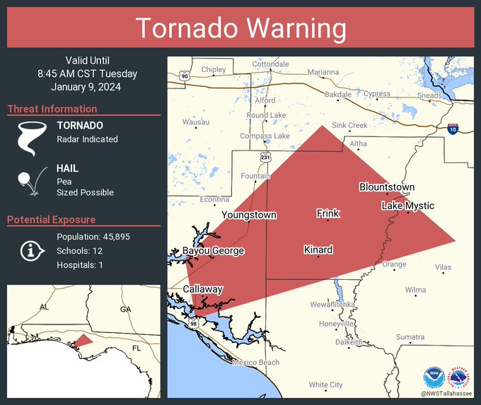
CALLAWAY, Florida – The National Weather Service in Tallahassee, Florida has issued a tornado warning for south-central Jackson County, northwestern Gulf County, east-central Bay County, Calhoun County, and west-central Liberty County in Florida’s Big Bend that will remain in effect until 8:45 a.m. Central Standard Time.
At 9:10 AM EST/8:10 AM CST, the severe thunderstorm was identified near Callaway, moving northeast at a swift pace of 60 mph. The primary hazard associated with this storm is a tornado, with radar indicating rotation.
The impact of this dangerous storm includes the risk of flying debris, posing a significant threat to those without adequate shelter.
Mobile homes are particularly vulnerable, with potential for damage or destruction. Additionally, damage to roofs, windows, vehicles, and trees is likely.
The storm is expected to reach Blountstown around 8:40 AM CST. Other locations impacted by this tornadic thunderstorm include Moose Pond, Clarksville, Abe Springs, College Station, Bayou George, Chipola, Camps Head, Scotts Ferry, Kennys Mill, and Estiffanulga.
Residents in the warned areas are strongly advised to take immediate precautions. Seek shelter in a basement or an interior room on the lowest floor of a sturdy building, and avoid windows.
If outdoors, in a mobile home, or in a vehicle, move to the closest substantial shelter and protect yourself from flying debris.
Copyright 2023-2025 FloridaWord.com

